Posted 7:07 p.m. Thursday, July 14, 2011

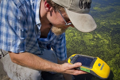 Ryan Perroy, UW-L assistant professor of geography, uses his GPS to find the next spot in the marsh with an elevated lead concentration.[/caption]
The dirt on UW-L geography: much more than maps
Geography isn’t just the study of where cities are located on a map. It goes much deeper. For two UW-L professors and their students it has taken them deep down into the mud of the La Crosse River marsh. There they’ve found something surprising — and potentially a threat to the waterfowl, muskrats, turtles and other species that live there. Marsh history The La Crosse Gun Club operated on the northeast side of Myrick Park between 1932 and 1963, and hosted regional, state and national trapshooting competitions. By the trail entrance on the marsh’s south side, big slabs of concrete mark spots where sportsmen aimed their shotguns at clay pigeons. The lead shot fired from their guns fell into the muddy waters and sank. [caption id="attachment_225" align="alignright" width="400"]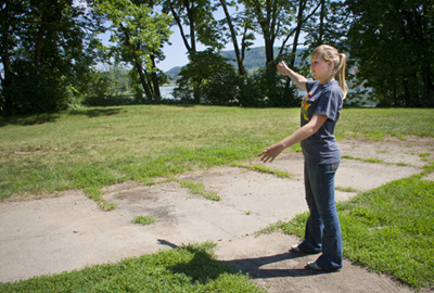 UW-L Student Sara Erickson explains how a shooting range was used between 1932 and 1963 on the northeast side of Myrick Park.[/caption]
“The bad news is all this lead is potentially contaminating the soil,” explains Colin Belby, a UW-L geography professor.
Belby and his colleague Ryan Perroy, also a geography professor, are creating a three-dimensional map of the marsh, which identifies spots where elevated lead concentrations have been found. Their research is funded in part by a 2011-12 UW-L faculty research grant.
The propeller motor hums as their wooden raft chugs across the algae-covered water. When they reach the proper GPS coordinates, they stop, submerge a metal core into the muck and pull up mud from up to 30 centimeters below. Neatly scraping layers of sediment into plastic bags, they’ll later use X-ray fluorescence to determine the concentration of lead in the soil.
[caption id="attachment_246" align="alignright" width="400"]
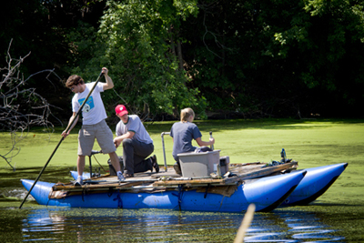 Jake Roberts, UW-L senior, Colin Belby, UW-L assistant professor of geography, and Sara Erickson, UW-L senior, move a raft through the marsh to collect soil samples.[/caption]
Preliminary data shows the concentration at greater than 1,200 parts per million in some places — a level three times higher than what the Environmental Protection Agency considers safe.
“We didn’t expect to see this much lead at the surface — it definitely meant we had a project to do,” said Belby.
What toxic lead levels might mean for the marsh
Studies done elsewhere have found ingestion of sediment and vegetation with high concentrations of lead can cause toxic buildup of lead in wildlife. Perroy and Belby stress their research is preliminary and there may be no environmental concerns for the wildlife or vegetation in the La Crosse River marsh. Right now their goal is to determine how much lead is in the marsh and where.
[caption id="attachment_249" align="alignright" width="400"]
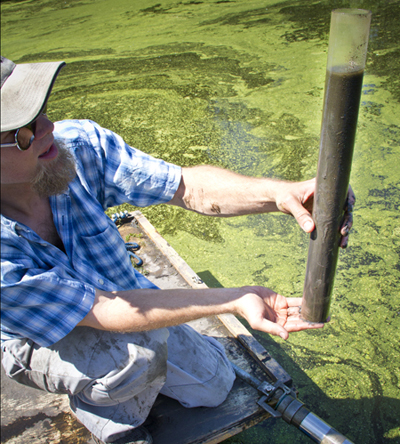 Ryan Perroy, UW-L geography professor, holds a core filled with soil that he and fellow researchers will later test for lead.[/caption]
However, if they do find toxic levels, the data could aid future chemical and biological studies at UW-L and elsewhere.
While collecting aquatic insects in the marsh a couple of years ago, Roger Haro, a UW-L biology professor, found several baby dragonflies with a deformed antennae. Even before Perroy and Belby started their research, Haro wondered whether lead from the shooting range could be affecting life in the marsh.
“Deformities can happen naturally, but anytime you come across one — especially in a small sample — it kind of raises a flag,” he said.
Potential follow-up research for Haro would be studying areas in the marsh where they’ve found high concentrations of lead to see if the incidence of deformities in invertebrates is higher in those areas.
“It will be interesting to see what they are finding,” he said. “We don’t know, but there could be long-term effects after this shooting range ceased operation.”
Gretchen Gerrish, UW-L assistant professor of biology, says if toxic lead levels are found, she’d like to see how crustaceans that lay eggs in the sediment have adapted to the contamination.
Gerrish would look at a specific type of crustacean whose eggs can live over 100 years in sediment. She can hatch out
[caption id="attachment_262" align="alignright" width="400"]
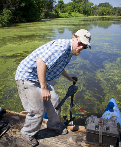 Ryan Perroy, UW-L assistant professor of geography, sets up equipment used to collect soil samples on the La Crosse River marsh.[/caption]
creatures pre-lead and post-lead, and then measure their ability to live in progressively higher concentrations of lead.
“Evolution in a short period of time is what I would be testing for,” she explains.
Collaboration among departments is a strength of UW-L, says Gerrish. She met Belby and learned about his research through UW-L’s River Studies Center, a non-curricular arm of the university focused on research and programming related to the Mississippi River and its resources.
The research findings could also be useful off campus.
Stephanie Hanna, education manager for the Myrick Hixon EcoPark, says the information Perroy and Belby generate could be used to help educate the public about the marsh, located in the EcoPark’s backyard. Hanna says the research would ultimately help people make decisions about living sustainability within their habitat.
Supporting student research in the process
“I didn’t really know all this was happening in the marsh,” says Sara Erickson, UW-L geography major who is collaborating on the research. “I’m glad we can help the environment and the people using the park.”
The support from UW-L to do this undergraduate research has been “awesome,” says Erickson. Over the years she has received funding from UW-L’s Undergraduate Research & Creativity Grant and The Dean’s Distinguished Fellowship program. Erickson is also in the McNair Scholars Program, which prepares under-represented, low-income or first-generation college students for graduate school.
But the financial support and research opportunity comes with some expectations of hard work on her part. She’s on the raft at 7:30 a.m. to collect mud before bringing it to the lab to analyze. And she keeps a positive attitude — even when faced with setbacks due to their swamp-like surroundings.
“We usually drop something in the water — unfortunately,” says Belby as he jumps into the lime-green covered water to find a small piece of equipment, which fell off the raft. “Ahhhh … so gross.”
Most people don’t realize geographers do this kind of environmental work, the geography professor notes. Only a small percentage of students start out at UW-L declaring a geography major. Most discover the field after taking some classes and realizing what geography really is.
“A lot of people think that geography is the study of state capitals,” Perroy explains. “But it actually covers so much more from how cities grow and develop to the global impacts of climate change to the distributions of contaminants in the environment.”
Geography majors go on to work for city planning departments, industry, the U.S. Geological Survey and the Department of Natural Resources. Others, like Perroy and Belby, venture into muddy waters and get dirty in the name of scientific research. And, when they come back, they hope to have data with potential environmental applications in the community where they live.
More photos of Belby and Perroy's research can be found here.
Today laws prohibit the use of lead shot in waterfowl hunting, and shooting ranges which discharge lead over wetlands are subject to regulations under the Clean Water Act.